


Geophysical assessments measure, map and image various subsurface physical properties of the earth’s crust just as the medical profession uses a variety of diagnostic techniques to measure and image the interior of the human body.
Geophysics is defined as an interdisciplinary physical science dealing with the nature of the earth and its environment through the interpretation of contrasting physical properties of materials. SME’s engineers use geophysical assessments to provide detailed characterizations of the subsurface in environmental, groundwater, natural resource, and geotechnical investigations and how they impact risk factors, design and construction costs for a wide range of projects. Preparing maps, cross sections and images of physical properties of the earth, we provide infrastructure, construction hazard and engineering design input including depth to bedrock, elastic properties, hazard discovery and site classification.
Geophysical Surveys
•Seismic
•Electrical Resistivity
•Ground Penetrating Radar (GPR)
•Electrical Resistivity
•Ground Penetrating Radar (GPR)
Geodynamics and Vibration
SME provides engineering services to monitor and evaluate existing (ambient) vibrations and vibrations from various man-made sources such as construction activities and machine foundations. Geodynamic engineers also use specialized seismic equipment to evaluate the potential response of subsoil and rock conditions during earthquake events and to provide design parameters for buildings to safely resist such seismic forces.
•Vibration Monitoring
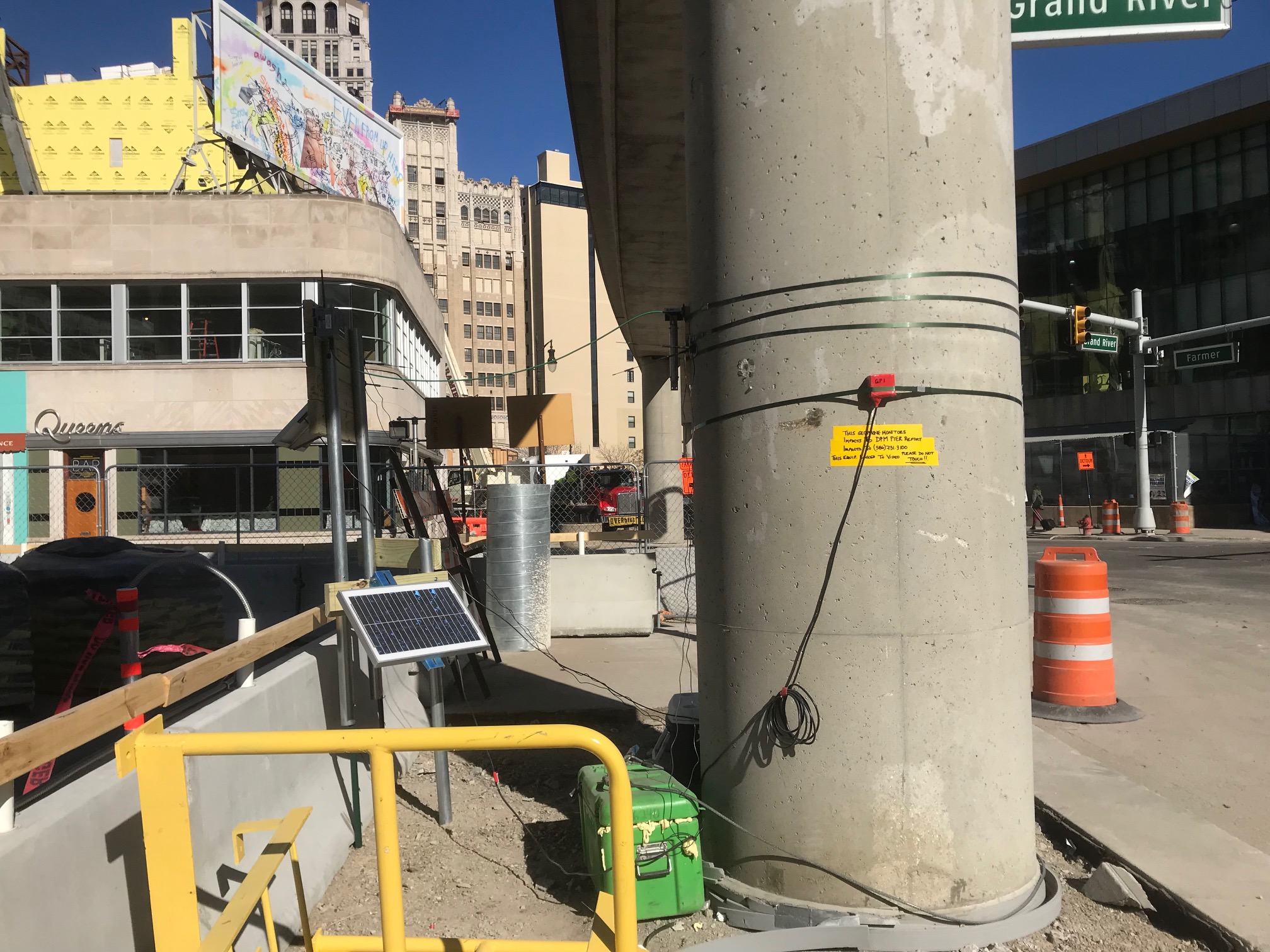
Demolition of existing structures, pile driving, vibratory compaction, deep dynamic compaction or other construction activities can generate vibrations which extend beyond the site boundaries. Special monitoring equipment is used to remotely collect, store and transmit data so engineers can assess the risk of damage to adjacent facilities and to provide recommendations to minimize possible damage.
•Site Seismic
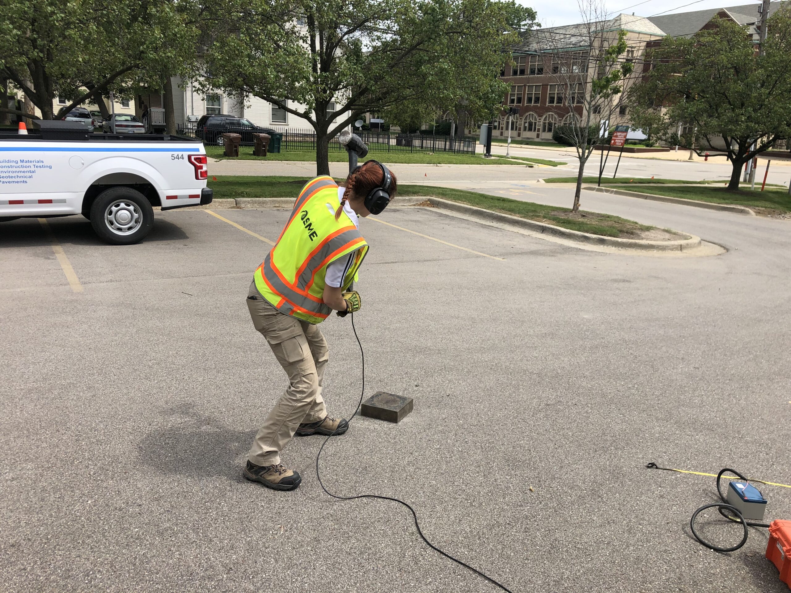
A proper identification of the seismic site classification used for structural design of buildings is a valued service. SME’s Multi-channel Analysis of Surface Waves (MASW) and Microtremor Array Method (MAM) equipment provide non-invasive seismic methods to develop a shear wave velocity profile to assist structural engineers with their building designs.
•Vibration Monitoring
Demolition of existing structures, pile driving, vibratory compaction, deep dynamic compaction or other construction activities can generate vibrations which extend beyond the site boundaries. Special monitoring equipment is used to remotely collect, store and transmit data so engineers can assess the risk of damage to adjacent facilities and to provide recommendations to minimize possible damage.
•Site Seismic
A proper identification of the seismic site classification used for structural design of buildings is a valued service. SME’s Multi-channel Analysis of Surface Waves (MASW) and Microtremor Array Method (MAM) equipment provide non-invasive seismic methods to develop a shear wave velocity profile to assist structural engineers with their building designs.